Satellite imagery shows Philippine construction on two islands in disputed Spratlys
Experts say the runway and port expansions will increase readiness amid Chinese escalations in the South China Sea.
The Philippines is actively upgrading facilities on two islands it controls in the disputed Spratly chain in the South China Sea, satellite images reviewed by Radio Free Asia revealed.
The expansion of the runway at Thitu Island and the port at Nanshan Island, are intended to solidify Manila’s physical presence in the Spratlys in response to recent Chinese escalations in the Spratly archipelago, a scattering of hundreds of small islands, atolls and reefs claimed by many different countries, experts said.
Once completed, Manila will have better access the two islands, making supply runs and other logistic challenges easier, thereby improving readiness to react to emergencies in territory it considers to be within its exclusive economic zone, they said.
“Hope” for a larger runway
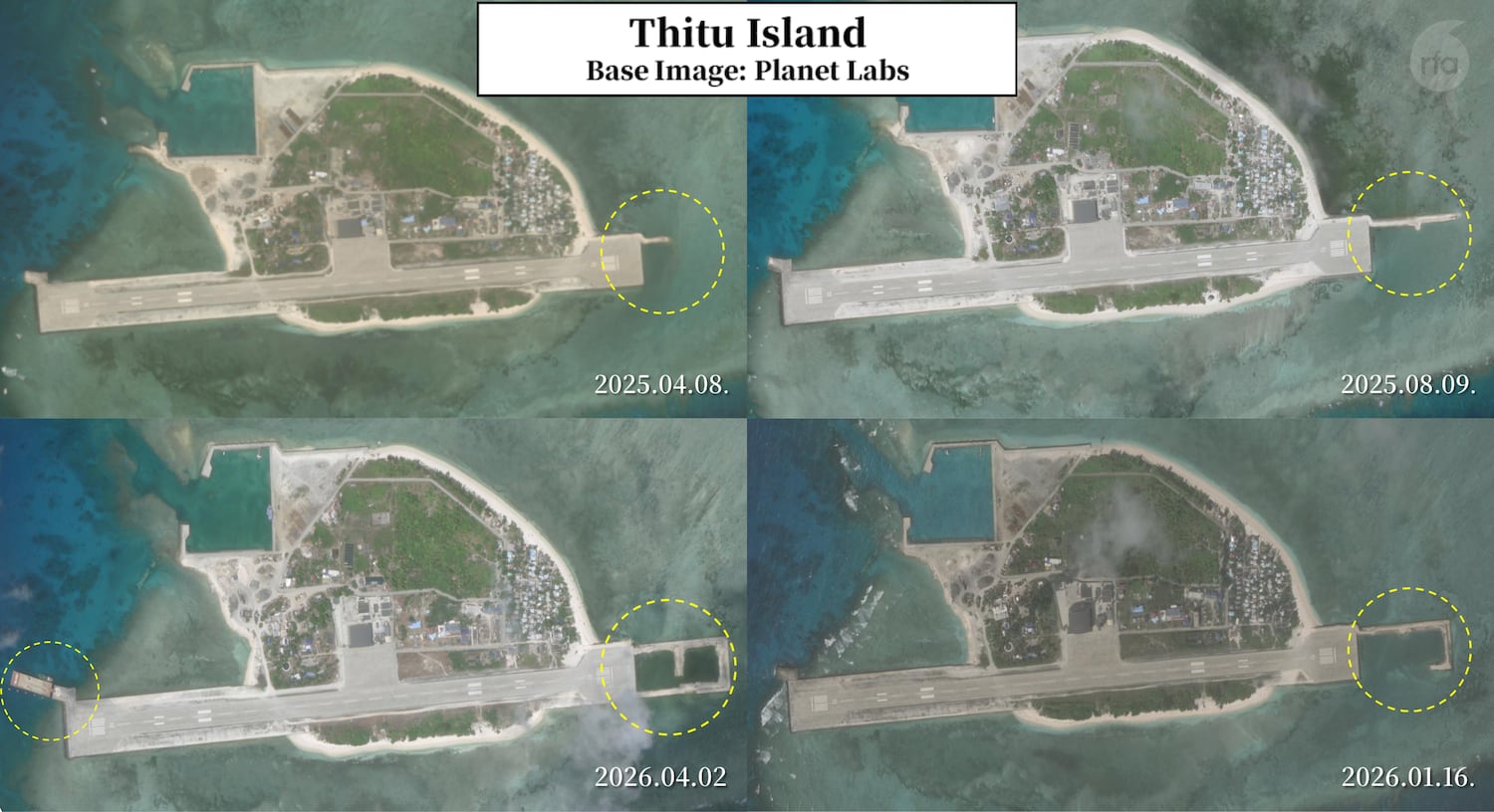
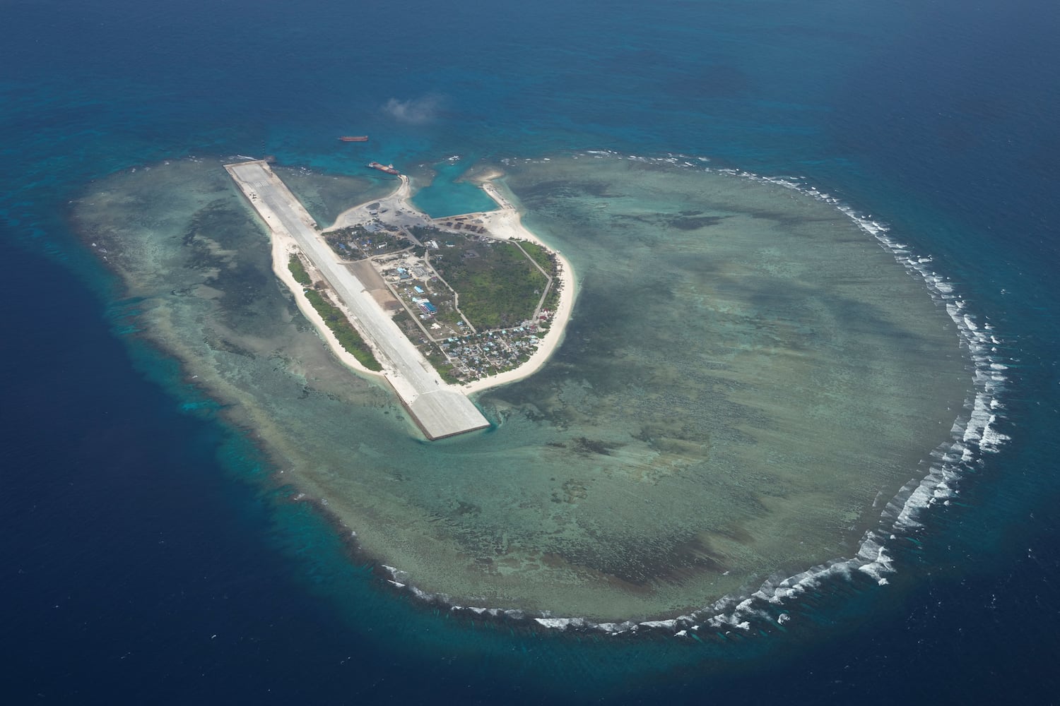
Thitu, called Pag-asa, meaning “Hope” in Tagalog, is the larger of the two islands, and is the only Philippine-administered feature in the Spratly Islands with a permanent civilian population. It was first occupied by the Philippines in 1974 and it is also claimed by China, Taiwan and Vietnam. Its most prominent manmade feature is a 1.3-kilometer (.8-mile) runway.
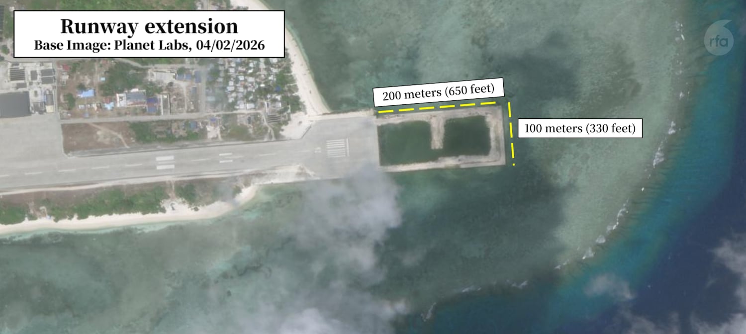
In its 2025 budget, Manila earmarked 1.65 billion pesos (US$27 million) to extend the runway to 1.5 kilometers (.93 miles) a length sufficient to accommodate certain variants of the F-16 fighter jet, as well as light combat and transport aircraft. Another 300 million pesos ($5 million) has been set aside for the construction of a sheltered port.
Satellite imagery captured by Planet Labs confirms that construction began shortly after the budget was approved and remains ongoing as of May 2026.
The roughly 200-meter (656-foot) extension appears to be over an area that was previously submerged.
In an image from April 2, a barge can be seen on the western part of the runway, likely delivering construction materials.
The runway extension marks a significant shift in the Philippines’ posture to strengthen the resilience of its outposts in the South China Sea, Harrison Prétat, deputy director of the Washington-based Asia Maritime Transparency Initiative, told RFA
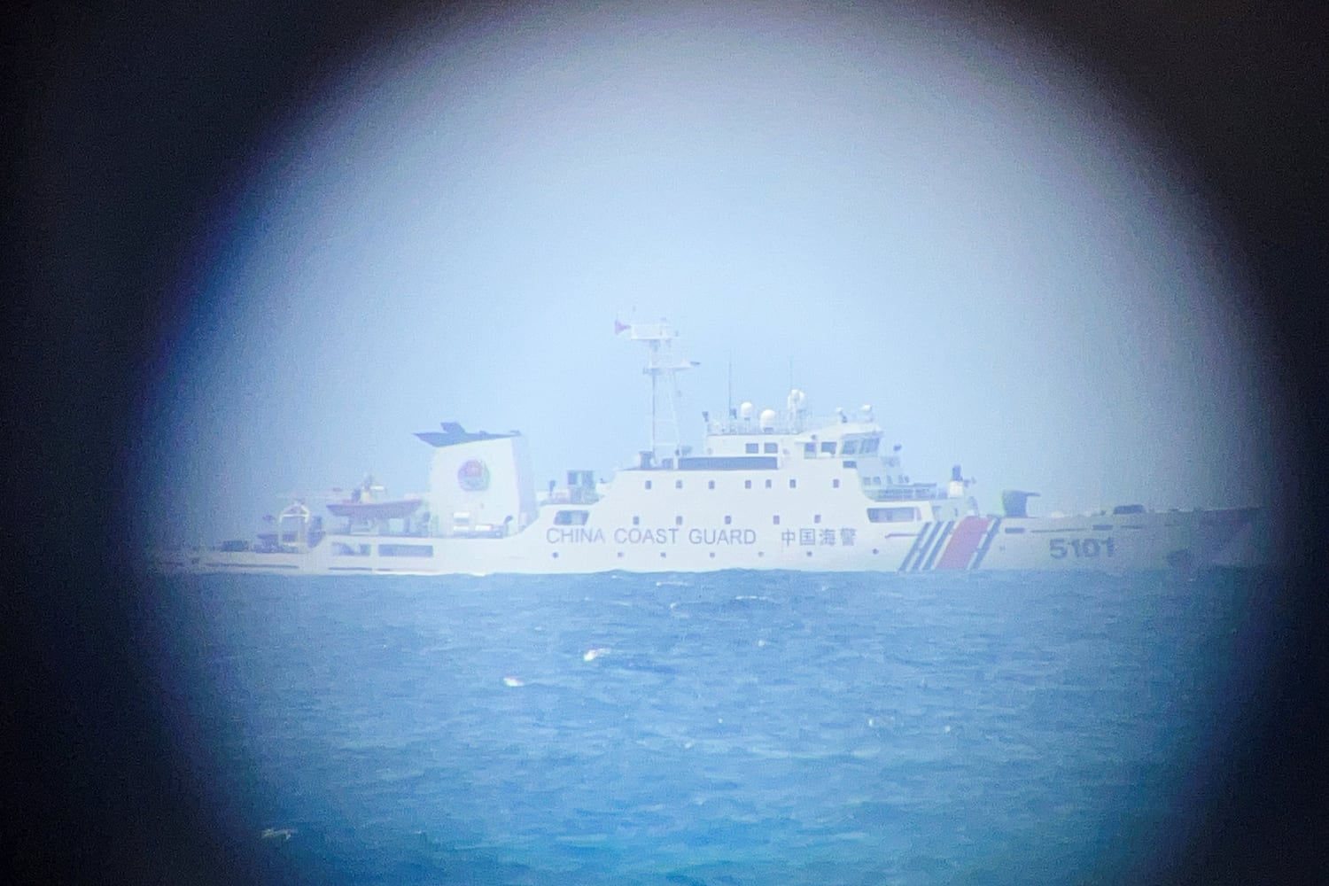
“The real recent drivers I think have been the tensions between China and Philippines at Second Thomas Shoal basically from around 2021 up until 2024,” said Prétat.
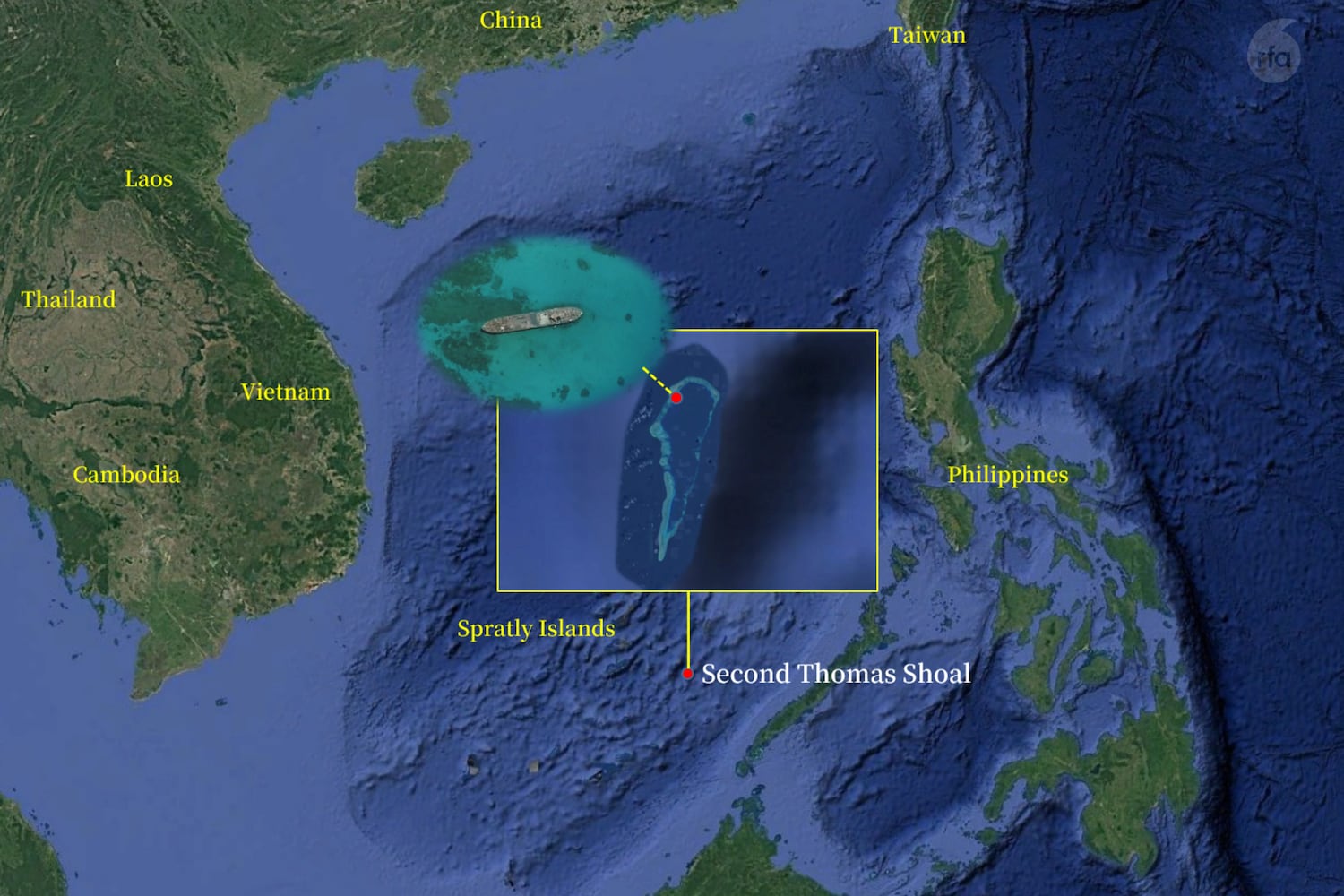
Second Thomas Shoal, located roughly 224 kilometers (139 miles) from Thitu has been a flashpoint between the two countries since 1999, when the Philippines deliberately grounded a navy ship on the shoal and stationed troops aboard. The vessel-turned-outpost, which requires constant resupply from the Philippine Coast Guard and Navy, has been at the center of escalating confrontations since approximately 2021.
China began using coast guard and naval vessels to interfere with and block those supply missions from the Philippines. Tensions reached a critical point in the summer of 2024, when Chinese personnel rammed Philippine vessels and boarded them and a Filipino sailor lost a thumb in the incident.
Shortly afterward, Manila and Beijing reached an agreement to reduce tensions at the shoal, but both sides recognized the situation had already grown too dangerous and volatile, Prétat noted.
“In that context, if you look at improvements to the runway at Thitu Island, it makes sense,” he said. “The more they can reinforce the access and the logistics capabilities of their outposts, I think it makes them a little more resilient to a situation like at Second Thomas Shoal.”
Zheng Zhihua, an associate professor specializing in maritime affairs at Shagnhai Jiao Tong University, told the South China Morning Post that Beijing would have significant concern if U.S. forces were able to use the facilities on the island. He added that if the expanded runway and shelter ports accommodated U.S. military aircraft or coast guard vessels, it could shift the strategic pressure in maritime maneuvers back onto China.
The small port in a “vast” sea
Nanshan Island is the eighth largest natural island of the Spratly Islands, located 98 miles (158 km) east of Thitu. Called Lawak, meaning “vast” in Tagalog, The Philippines first took possession in 1974, and it is the fourth largest of the Philippine-occupied islands – situated far from the main areas of Chinese maritime activity in the region.
Satellite imagery captured from October 2025 through April 2026 shows that port expansion on Nanshan Island remains ongoing but is still in early stages.
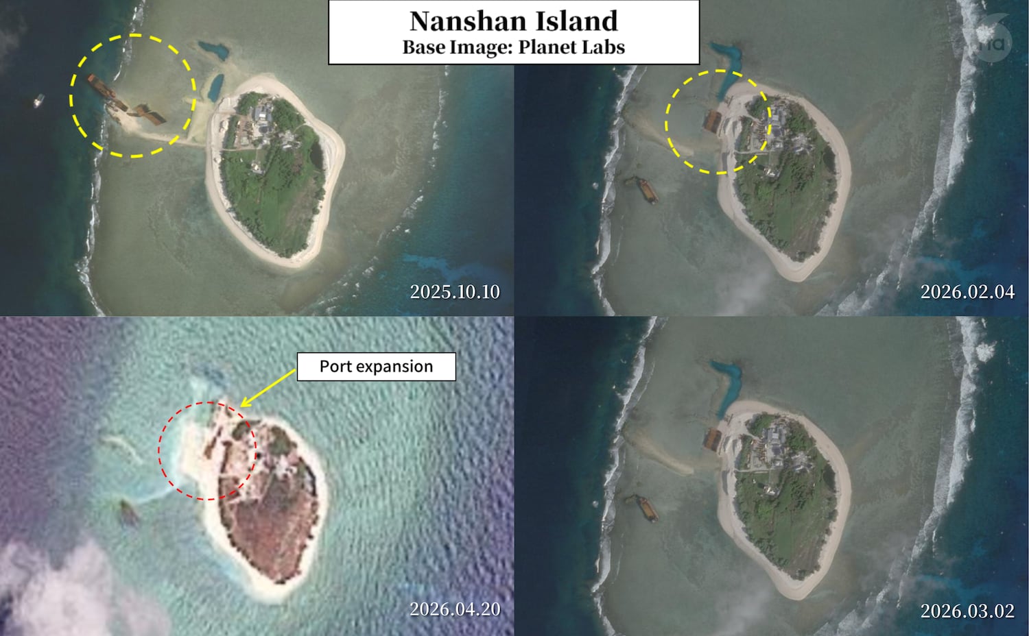
The Philippine government appropriated more than 1 billion pesos ($27 million ) for the sheltered port facility on Nanshan Island, to replace the current port that has a narrow entry channel and is too shallow for larger ships.
Experts think that upgrades on Nanshan Island would undoubtedly bolster the Philippine Coast Guard’s docking capabilities and strengthen enforcement operations in the area.
“The number one impact, I think, will be on the Philippines’ ability to continue using those facilities,” said Prétat said. “We don’t know what the port will look like yet because it’s early, but if they can have a more accessible port, it would make that outpost a bit easier to resupply and easier to operate from.”
Strong diplomatic messages
Philippine officials have paired the infrastructure push with pointed diplomatic messaging. In February, lawmaker Risa Hontiveros and Philippine Coast Guard spokesman Jay Tarriela visited Thitu Island, meeting with local residents and issuing a firm statement of sovereignty. During the visit, Hontiveros said, “We will never give up Spratly Islands, including Thitu.”
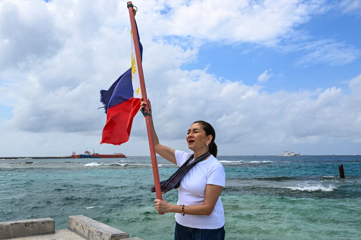
On April 9, the Philippines unveiled a new coast guard command base on the island in a formal ceremony attended by Transport Secretary Giovanni Lopez, Sen. Erwin Tulfo, and Coast Guard commander Adm. Ronnie Gil Gavan said the base represents a permanent step to demonstrate that the coast guard is ready to defend the country’s interest in the waters, its fishermen, their livelihood and, most importantly, its sovereignty.
Prétat said the Philippines navy is still at a significant disadvantage in the Spratly Islands compared with China, which maintains an extensive coast guard fleet and a network of large bases throughout the South China Sea- enabling it to deploy vessels across the region on short notice.
“Both of these expansions ― on Thitu Island and Nanshan Island ― are part of efforts by the Philippines to increase its patrols and increase its activity in the South China Sea,” said Prétat. “The Philippines is trying to improve this ability as much as it can to keep its ships out there ― to monitor what is going on, have maritime domain awareness, access rotate troops, conduct logistics, and maintain some type of presence.”
Edited by Eugene Whong.
This article has been sourced from various publicly available news platforms around the world. All intellectual property rights remain with the original publishers and authors. Unshared News does not claim ownership of the content and provides it solely for informational and educational purposes voluntarily. If you are the rightful owner and believe this content has been used improperly, please contact us for prompt removal or correction.